The ALTA Survey Table A lists items that are an optional part of the ALTA/NSPS Survey. We will discuss these items and what they reveal when added to your ALTA Survey.
ALTA Surveys provide information that would not otherwise be available to interested parties in a real estate transaction. While the information provided is critical, the great value of these surveys lies in the customization beyond the standard survey. These customizable options can be found on the ALTA Survey Table A, which is a list of items that the client can request to be included in the survey to meet their unique needs.
Understanding the Basics of Table A
An ALTA Survey provides strict standards that allow for consistent results no matter where the survey is conducted. However, just as every piece of property is not the same, it is not useful or practical for an ALTA Survey to leave out critical information about the property in question if there are additional items that would be of interest to commercial real estate investors.
This is where the importance of Table A comes in. When requesting items from Table A to be included in an ALTA Survey, the client should be conscious of the specifics of their real estate transaction. For example, if you plan to purchase a property and develop it for a determined purpose, then you will be interested to know that your development plans would be permitted under current or potential local zoning laws. In this situation, Zoning Information (Item 6) would be requested as a part of the survey.
A Look at Table A Items
In the most recent revision of the ALTA/NSPS Land Title Survey, there are 19 discretionary Items on Table A with a space for a 20th Item, such as an engineering design survey.
Item 1: Monuments placed
Setting new monuments to define survey boundaries provides added protection to interested parties involved in the transaction. Even if monuments were placed in a prior survey, including this Item allows the surveyor to verify that they were accurately placed and if new ones need to be placed. It should be noted that several states, like California, Washington, Oregon, and others may have specific requirements for setting monuments such as requiring a plat submittal review, approval, and a recordation process by various local jurisdictions. This can add additional costs, as well as time, thereby possibly impacting transactional timelines.
Item 2: Address(es) of the surveyed property
This Item should be included, since the surveyor will be confirming whether or not it is checked.
Item 3: Flood zone classification
This information can impact the potential for development, insurance costs, and even the decision to purchase the property and should usually be selected.
Item 4: Gross land area
Depending on the intended use of the property, the square footage and total land area may be of interest.
Item 5: Vertical relief
This Item is often included if there is construction planned for the property since it provides topographic data.
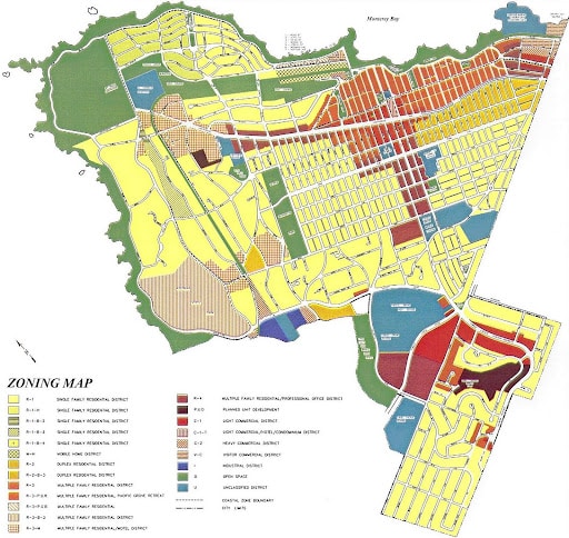
Item 6: Zoning
As mentioned above, this Item is especially of interest if construction is planned. It provides the property zoning classification and any setback requirements, density, height and floor space restrictions, parking requirements, and other specific items relating to the zoning conformance of the property.
Item 7: Exterior dimensions of buildings
Item 7 identifies the dimensions of any buildings present on the property and is especially important if there are any zoning considerations or if the value of the property needs to be assessed.
Item 8: Substantial features
Substantial features include improvements to the property that are not the primary building. This can include sheds, walls, fences, pools, signage, and other additions to the property.
Item 9: Parking
Item 9 identifies the number of parking spaces present on the property, which is especially important if the number of spaces needs to meet zoning regulations.
Item 10: Party walls
This Item identifies any walls that are shared between neighboring properties.
Item 11: Location of utilities
Location of utilities determines the location of underground gas lines, electrical, water, and any other utilities that exist on or serve the property.
Item 12: Governmental Agency survey-related requirements
This Item would be used to meet HUD financial requirements, if the land is leased on Bureau of Land Management land, or in other similar situations involving federal property.
Item 13: Names of adjoiners
Item 13 notes the names of the owners of the properties adjoining the property being surveyed.
Item 14: Distance to the nearest intersection
As the name implies, Item 14 determines the distance to the nearest intersection to the property and helps ensure it meets zoning requirements.
Item 15: Location of features by something other than groundbased surveying
This option can be selected by the client or suggested by the surveyor to locate some features by means other than groundbased surveying, such as the use of drones, remote sensing, and more. This option should be discussed in detail with the individual in need of the survey and potentially their title insurance company, depending upon the needs and use of the survey.
Item 16: Evidence of recent earth-moving work
Item 16 can include building construction or building additions observed in the process of conducting the fieldwork.
Item 17: Proposed changes in street right-of-way
This Item notes any possible changes in street right-of-way, which can impact traffic near the property and would be of interest to the real estate investor.
Item 18: Plottable offsite easements
If this Item is not selected, easements will still be indicated. However, selecting Item 18 means that the easements will be subject to minimum standard requirements and can add cost and time to the survey. Often, if extensive offsite easements affect the property (appurtenant easement), a graphic depiction of the easement may be offered in lieu of a ground survey. This should be discussed prior to engaging the surveyor.
Item 19: Professional liability insurance
Selecting Item 19 requires insurance to be obtained by the surveyor for the duration of the contract term.
Item 20: Additional items
This line is left blank on Table A to allow for additional items to be added as negotiated with the surveyor.
National Due Diligence Services is Your Due Diligence Partner
As you can see, there is a great deal of value and information that can be obtained from ALTA Surveys that can aid in the decisions made throughout any commercial real estate transaction. It’s even more important that you have a capable surveying team on your side.
Our team of experienced surveyors works to provide this information efficiently to exceed our commitments and promote the success of our clients. Contact us today to get started.


