Flood Determination
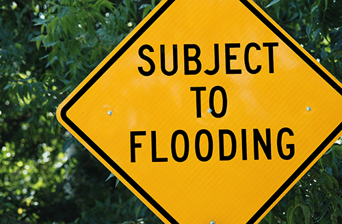 Borrowers may be required to provide flood insurance if there is risk of loss to a property that is located in a floodplain. Not only is it a good idea to order a Flood Determination certificate for your own assurance, but lenders require them in nearly every real estate transaction.
NDDS has nationwide service providing standard flood hazard determination information based on the Federal Emergency Management Agency or FEMA. FEMA’s Flood Maps are based on survey data. Changes in the status of a property may occur any time, so the maps are continually updated. These maps reflect whether or not the location is in a low, moderate or high risk area. Areas that are in high risk areas are called Special Flood Hazard Areas or SFHA’s or floodplains. When you order a “Life of Loan” Flood Determination Certificate, your flood risk status is tracked throughout the life of the loan and your lender is notified of any changes to the flood hazard maps.
FEMA Form 086-0-32 will be provided. This form indicates the current flood hazard area and verifies the availability and requirements of flood insurance via the National Flood Insurance Program (NFIP). Our team will examine the NFIP map, any Federal Emergency Management Agency revisions to it, and any other information needed to locate the building on the NFIP map. The report providing the Flood Zone Determination will be clarified and will state whether or not the property in within a S(F)HA. Lenders accept this certification as proof that the subject property is “in” or “not in” a floodplain.
Elevation Certificates for Flood Insurance
Homes and buildings in high-risk flood areas with mortgages from federally regulated or insured lenders are required by law to have flood insurance. In high-risk areas, there is at least a 1 in 4 chance of flooding during a 30-year mortgage. Flood Insurance companies require a licensed surveyor or engineer to prepare a FEMA approved certificate, Form 81-31, known as the Elevation Certificate, in order to assess the risk and determine the proper premiums when providing flood coverage.
The Elevation Certificate reports:
- What flood zone and flood map the building lies in
- The Base Flood Elevation (BFE) used for assessing the risk of flooding
- The actual elevations measured by a surveyor of:
- Building’s lowest floor
- Any additional floors
- The ground elevations surrounding the building
- The elevations of machinery (A/C units, generators, etc.) that service the building
- Pictures of the building from several views
All of these elements are crucial for the flood insurance company to provide you with the proper flood insurance coverage.
Link to FEMA