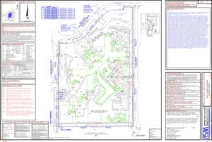
The ALTA Land Survey has remained the gold standard in the world of land surveying for more than 60 years. Learn why the tool was created and the benefits it brings to the due diligence process.
A completed ALTA Land Survey is a critical checkpoint in the real estate acquisition process. The survey is beneficial to nearly all parties involved in a transaction—from the buyer to the lender—and provides valuable details on risks, boundaries, and other significant observations. An experienced survey company can expedite the process to make sure you stay on schedule, all while saving you time and money in the long haul.
As the nation’s premier surveying and mapping company, National Due Diligence Services (NDDS) is one of the largest providers of assessment services like the ALTA Land Survey. We’re taking a deep-dive into the history of the survey, the factors that prompted its development, and more.
The History of the ALTA Land Survey
The ALTA Land Survey, also known as the American Land Title Association survey (ALTA) was originally developed in 1962. Created by ALTA and the National Society of Professional Surveyors (NSPS), it was designed to establish a uniform surveying system across the United States.
Until this point, a central surveying standard did not exist. Technology was also far less advanced than it is today. The old land survey method varied depending on the surveyor and the location of a property, which made it difficult for insurance companies to properly assess the risk and protection of an investment.
The lack of a standardized surveying system was also challenging for buyers and sellers who were struggling to understand a property’s compliance and other factors that might affect its value.
The first iteration of the ALTA Land Survey is not much different than the current version used today. It encapsulated all of the vital details about a property, including boundaries, easements, zoning, regulatory requirements, environmental hazards, and more.
Decades later, the ALTA Land Survey represents the highest standards in the industry and remains a critical step in commercial real estate due diligence.
The ALTA Survey Process
During an ALTA Land Survey, a land survey company will log unrecorded information and identify boundary lines, water features, utility connection points, and more. This process also allows for the location of encroachments, easements, and other areas that may be a future concern to anyone investing in a commercial property. An ALTA Land Survey can significantly reduce liability for lenders, buyers, and title insurance companies by providing the most in-depth survey of the property.
The survey process will produce:
- A detailed land parcel map outlining exact property lines, improvement information (like height, setback, and size), and other land-ownership elements.
- Any additional findings by your surveyor.
Revisions to the ALTA Land Survey
From time to time, the Minimum Standard Detail Requirements of an ALTA Survey are modified as needed to accommodate:
- Changes in local, state, or federal regulations.
- Feedback from lenders, buyers, sellers, and title insurance companies.
- More advanced technology.
- New best practices in the surveying process.
The current ALTA Land Survey Minimum Standard Detail Requirements were released on February 23, 2021 to reflect the following changes:
- Clients must show proof of underground utilities, and surveyors must show evidence of underground utilities (or markings).
- Surveyors are no longer required to map wetland delineation markers.
- Utility poles that are located on or within 10 feet of a property can be used as evidence of easements or burdened property. Surveyors must include the source, or lack thereof, of those utility markings.
- Tax parcels are required for unplatted adjoining properties.
- All surveyors must include a summary of easements and rights of way. If new easements are discovered that are not logged, they must be shown to a title insurer.
Schedule an Assessment with National Due Diligence Services
With 25 years of experience, NDDS is one of the fastest commercial due diligence firms in the nation, boasting a one-stop-shop model for due diligence products. Our team will keep your project well-managed, on time, and compliant with local, state, and federal regulations.
In addition to our surveying services, NDDS also specializes in Environmental Assessments, Zip Maps, Land Development Services, and more. Contact us today to speak with our team and learn all that NDDS can do for your industry.

